
As part of my MA in Walking Practice, I invited visitors to Lundy to map places they love to walk to. What emerged was a wonderfully creative mix—watercolors, pen and ink sketches, textiles, and even cartoons. Each map told a story, not just of the place but of the experience of finding it.
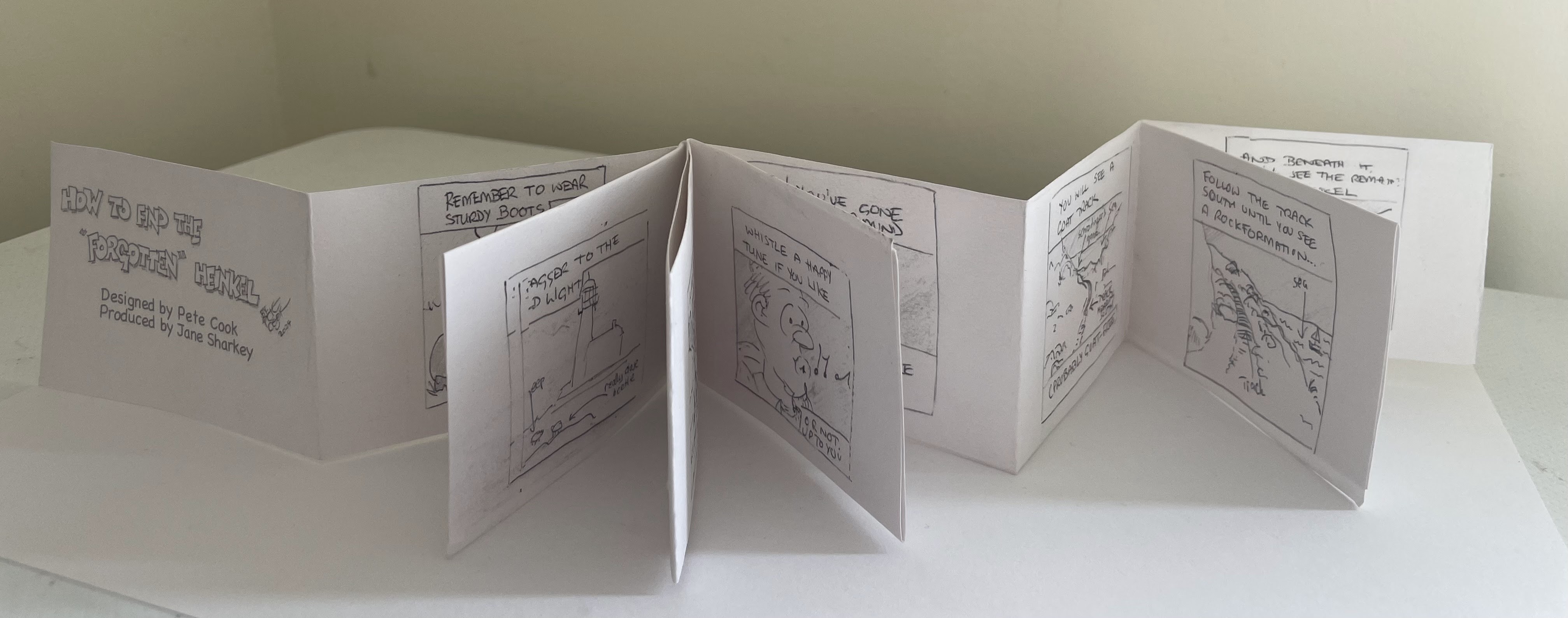
One particularly fun map was created by Pete Cook, a volunteer on the island, who used cartoons to guide people to the remains of a crashed Heinkel on the West Coast. What makes it so engaging is how it assumes you’ve missed the site and backtracks—because that’s exactly what happens when trying to find it!
Inspired by these maps, I’ve decided to take them further, creating a small series of tiny meandering books from these maps, each one focuses on a different place on Lundy. These books aren’t just about navigation; they celebrate the experience of moving through the landscape in a more playful, personal way.
By following these maps, I hope people will discover new perspectives on Lundy, embracing the joy of getting lost and the thrill of finding their way again.
I have created a few copies which will be available, with contributions to the Lundy Fund.

You must be logged in to post a comment.